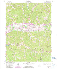
1958 Map of Scott Depot
USGS Topo · Published 1989About this map
Teays Valley serves as the central corridor of this West Virginia landscape, showing the suburban and industrial expansion along the Hurricane Creek drainage during the mid-to-late 20th century. The map illustrates a transitional period for the communities of Teays and Hurricane, where traditional rural landmarks like Black Lick Sch and Providence Ch coexist with newer developments such as the Teays Valley Lakes and various trailer parks. The importance of regional infrastructure is evident in the prominent corridors of the Midland Trail, a network of pipelines, and the Telephone Line crossing the Curry and Jefferson districts. Along the southern edge, the terrain becomes more dissected toward Coal Mtn, while the Putnam Co Kanawha Co boundary line indicates the map's position at a vital county crossroads. Local history is anchored by sites like Scott Depot and the Lawrence Cem, reflecting generations of settlement within the hollows and along the many forks of the Poplar Branch.
Find a feature on this map
59 named features on this map. Tap any name to fly to it.
Don’t see what you’re looking for? This feature index may not catch every label — zoom into the map to look around manually.
Map Details
Editions of this 1958 Scott Depot Map
4 editions found
Other maps of this area

1892 · Huntington
USGS Topo · 1:125,000

1898 · Huntington
USGS Topo · 1:125,000

1899 · Charleston
USGS Topo · 1:125,000

1902 · Milton
USGS Topo · 1:62,500

1906 · Glenwood
USGS Topo · 1:62,500

1906 · Winfield
USGS Topo · 1:62,500

1908 · Glenwood
USGS Topo · 1:62,500

1908 · Winfield
USGS Topo · 1:62,500

1909 · Saint Albans
USGS Topo · 1:62,500

1931 · Saint Albans
USGS Topo · 1:62,500