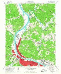
1958 Map of Saint Albans
USGS Topo · Published 1967About this map
The Kanawha River serves as the industrial and transportation spine of this region during the late 1950s, defining the development of Saint Albans and Nitro. The landscape reflects a transition from river-bottom industry and residential expansion to the coal-rich hills of Putnam and Kanawha counties. Notable institutional footprints include the campus of West Virginia State College at Institute and the historic Indian Mound nearby.
Find a feature on this map
71 named features on this map. Tap any name to fly to it.
Don’t see what you’re looking for? This feature index may not catch every label — zoom into the map to look around manually.
Map Details
Editions of this 1958 Saint Albans Map
4 editions found
Other maps of this area

1899 · Charleston
USGS Topo · 1:125,000

1906 · Kenna
USGS Topo · 1:62,500

1906 · Winfield
USGS Topo · 1:62,500

1907 · Kenna
USGS Topo · 1:62,500

1908 · Winfield
USGS Topo · 1:62,500

1909 · Charleston
USGS Topo · 1:62,500

1909 · Saint Albans
USGS Topo · 1:62,500

1931 · Saint Albans
USGS Topo · 1:62,500

1931 · Charleston
USGS Topo · 1:62,500

1933 · Saint Albans
USGS Topo · 1:62,500