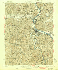
1933 Map of Saint Albans
USGS Topo · Published 1939About this map
The Kanawha River serves as the industrial and transportation backbone of this region during the 1930s, connecting established river towns like Saint Albans and Nitro. The influence of the river is complemented by the Chesapeake and Ohio Railway and the New York Central Railroad, which follow the valley corridors. Significant rural infrastructure is evident through the dense placement of educational and religious centers, such as the New Hope Church and the Infirmary School.
Find a feature on this map
107 named features on this map. Tap any name to fly to it.
Don’t see what you’re looking for? This feature index may not catch every label — zoom into the map to look around manually.
Map Details
Editions of this 1933 Saint Albans Map
2 editions found

Other maps of this area

1892 · Huntington
USGS Topo · 1:125,000

1898 · Huntington
USGS Topo · 1:125,000

1899 · Charleston
USGS Topo · 1:125,000

1902 · Milton
USGS Topo · 1:62,500

1902 · Midkiff
USGS Topo · 1:62,500

1906 · Glenwood
USGS Topo · 1:62,500

1906 · Kenna
USGS Topo · 1:62,500

1906 · Winfield
USGS Topo · 1:62,500

1907 · Kenna
USGS Topo · 1:62,500

1907 · Midkiff
USGS Topo · 1:62,500