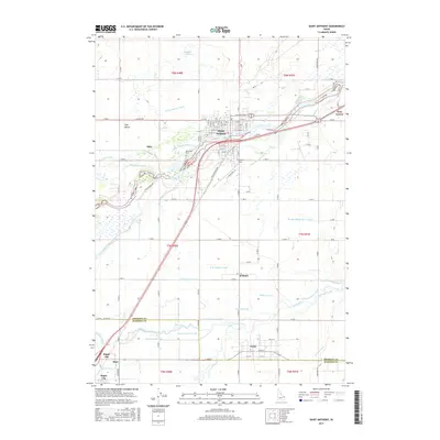
2017 Map of Saint Anthony
USGS Topo · Published 2017About this map
Saint Anthony serves as the hub of a complex irrigation landscape in eastern Idaho, where the Teton River and South Teton River feed a vast network of waterworks. This modern survey illustrates the hydraulic engineering required to transform the Egin Bench into productive land, featuring the Saint Anthony Canal, Independent Canal, and Salem Union Canal. The map captures the meeting point of Fremont and Madison counties, showing the rural communities of Twin Groves, Wilford, and Teton as they exist today. Local history landmarks such as Riverview Cemetery and Stanford Field sit just outside the primary settlement at Saint Anthony, providing essential reference points for genealogists and researchers tracking property and infrastructure in the Henrys Fork region.
Find a feature on this map
51 named features on this map. Tap any name to fly to it.
Don’t see what you’re looking for? This feature index may not catch every label — zoom into the map to look around manually.
Map Details
Editions of this 2017 Saint Anthony Map
This is the sole edition of this map. No revisions or reprints were ever made.
Other maps of this area

1948 · Parker
USGS Topo · 1:24,000

1949 · Rexburg
USGS Topo · 1:24,000

1949 · Newdale
USGS Topo · 1:24,000

1950 · Parker
USGS Topo · 1:24,000

1950 · Rexburg
USGS Topo · 1:24,000

1950 · Newdale
USGS Topo · 1:24,000

1950 · St Anthony
USGS Topo · 1:24,000

1951 · Moody
USGS Topo · 1:24,000

1951 · White Owl Butte
USGS Topo · 1:24,000

1955 · Ashton
USGS Topo · 1:250,000