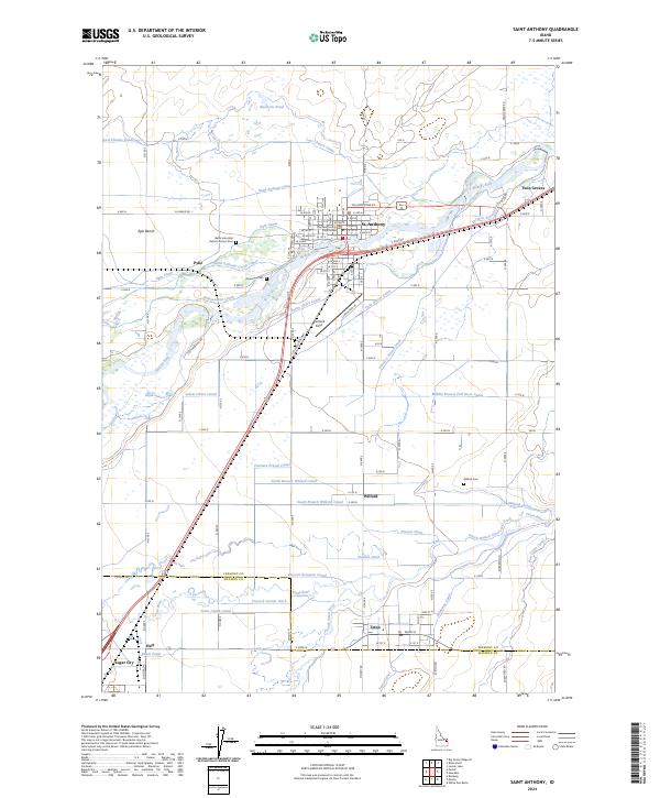
2024 Map of Saint Anthony
USGS Topo · Published 2024About this map
St. Anthony serves as the focal point of this Eastern Idaho region, situated where the Henrys Fork of the Snake River meets an extensive network of irrigation infrastructure. The town's civic heart is anchored by the Fremont County Courthouse, while the surrounding landscape reveals the historical importance of water management through numerous named channels like the Last Chance Canal and Saint Anthony Canal. To the south, the settlements of Wilford and Teton are defined by their proximity to the Teton River, highlighting a pattern of river-valley development that stretches toward Sugar City. Local history and genealogy are well-represented by several burial sites, including the Riverview Cem, the Wilford Cem, and the specialized Idaho Industrial Reform School Cem. This map illustrates the intersection of wild waterways and human engineering, from the northern Egin Bench down to the complex confluence of ditches and forks that support the agricultural life of the Upper Snake River Plain.
Find a feature on this map
84 named features on this map. Tap any name to fly to it.
Don’t see what you’re looking for? This feature index may not catch every label — zoom into the map to look around manually.
Map Details
Editions of this 2024 Saint Anthony Map
This is the sole edition of this map. No revisions or reprints were ever made.
Other maps of this area

1948 · Parker
USGS Topo · 1:24,000

1949 · Rexburg
USGS Topo · 1:24,000

1949 · Newdale
USGS Topo · 1:24,000

1950 · Parker
USGS Topo · 1:24,000

1950 · Rexburg
USGS Topo · 1:24,000

1950 · Newdale
USGS Topo · 1:24,000

1950 · St Anthony
USGS Topo · 1:24,000

1951 · Moody
USGS Topo · 1:24,000

1951 · White Owl Butte
USGS Topo · 1:24,000

1955 · Ashton
USGS Topo · 1:250,000