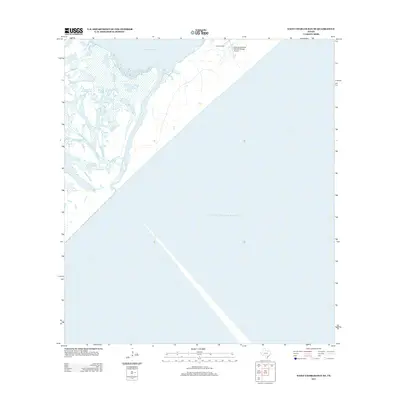
2013 Map of Saint Charles Bay SE
USGS Topo · Published 2013About this map
The coastal wetlands and maritime reaches of Aransas National Wildlife Refuge dominate this 2013 survey of the Texas shoreline. The map documents a landscape defined by the transition from land to water, featuring the complex marshy network of Vinson Slough and the open expanse of Mesquite Bay. This area serves as a critical environmental intersection where inland ranching at Wynne Ranch meets the vast waters of the Gulf of Mexico. The presence of the Aransas National Wildlife Refuge Airport underscores the logistical requirements of managing such a significant coastal preservation zone. The intricate coastline captured here illustrates the dynamic nature of the Texas Gulf Coast, where shallow bays and winding sloughs create a unique habitat separate from the deeper maritime waters to the southeast.
Find a feature on this map
6 named features on this map. Tap any name to fly to it.
Don’t see what you’re looking for? This feature index may not catch every label — zoom into the map to look around manually.
Map Details
Editions of this 2013 Saint Charles Bay SE Map
This is the sole edition of this map. No revisions or reprints were ever made.
Other maps of this area

1950 · Corpus Christi
USGS Topo · 1:250,000

1951 · Allyns Bight
USGS Topo · 1:24,000

1952 · St. Charles Bay SW
USGS Topo · 1:24,000

1952 · St. Charles Bay
USGS Topo · 1:24,000

1952 · Mesquite Bay
USGS Topo · 1:24,000

1952 · Panther Point
USGS Topo · 1:24,000

1952 · St. Charles Bay SE
USGS Topo · 1:24,000

1953 · Beeville
USGS Topo · 1:250,000

1956 · Corpus Christi
USGS Topo · 1:250,000

1956 · Beeville
USGS Topo · 1:250,000