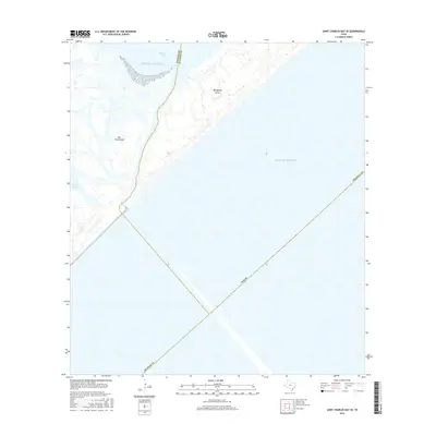
2016 Map of Saint Charles Bay SE
USGS Topo · Published 2016About this map
San Jose Island and Matagorda Island dominate this coastal survey, where the barrier islands are separated by a shifting interface between the Gulf of Mexico and the inland waters. This 2016 topographic study captures the precise boundary between Aransas and Calhoun counties as it cuts through Mesquite Bay. The map provides a high-resolution view of the wetland margins and shoreline dynamics of Vinson Slough and the surrounding coastal marsh. Because much of this land is located within sensitive ecological zones or government-managed areas, this survey serves as a vital record of the terrain as it existed in the mid-2010s, tracing the landforms and tidal channels that define this portion of the Texas coast.
Find a feature on this map
9 named features on this map. Tap any name to fly to it.
Don’t see what you’re looking for? This feature index may not catch every label — zoom into the map to look around manually.
Map Details
Editions of this 2016 Saint Charles Bay SE Map
This is the sole edition of this map. No revisions or reprints were ever made.
Other maps of this area

1950 · Corpus Christi
USGS Topo · 1:250,000

1951 · Allyns Bight
USGS Topo · 1:24,000

1952 · St. Charles Bay SW
USGS Topo · 1:24,000

1952 · St. Charles Bay
USGS Topo · 1:24,000

1952 · Mesquite Bay
USGS Topo · 1:24,000

1952 · Panther Point
USGS Topo · 1:24,000

1952 · St. Charles Bay SE
USGS Topo · 1:24,000

1953 · Beeville
USGS Topo · 1:250,000

1956 · Corpus Christi
USGS Topo · 1:250,000

1956 · Beeville
USGS Topo · 1:250,000