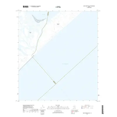
2019 Map of Saint Charles Bay SE
USGS Topo · Published 2019About this map
San Jose Island and Matagorda Island define the barrier landscape along the Texas coast in this 2019 survey. Separated from the mainland, these narrow landforms frame the entrance to Mesquite Bay and the intricate coastal wetlands of the region. The map highlights the shifting interface between the Gulf of Mexico and the interior estuarine systems, tracing the tidal dynamics through Vinson Slough. The boundary between Aransas and Calhoun counties cuts diagonally across the open water, illustrating how maritime jurisdictions are defined even far from the immediate shoreline. This map captures the pristine and relatively undeveloped character of these barrier islands, providing a clear record of the coastal topography and its natural inlets as they existed in the late 2010s.
Find a feature on this map
7 named features on this map. Tap any name to fly to it.
Don’t see what you’re looking for? This feature index may not catch every label — zoom into the map to look around manually.
Map Details
Editions of this 2019 Saint Charles Bay SE Map
This is the sole edition of this map. No revisions or reprints were ever made.
Other maps of this area

1950 · Corpus Christi
USGS Topo · 1:250,000

1951 · Allyns Bight
USGS Topo · 1:24,000

1952 · St. Charles Bay SW
USGS Topo · 1:24,000

1952 · St. Charles Bay
USGS Topo · 1:24,000

1952 · Mesquite Bay
USGS Topo · 1:24,000

1952 · Panther Point
USGS Topo · 1:24,000

1952 · St. Charles Bay SE
USGS Topo · 1:24,000

1953 · Beeville
USGS Topo · 1:250,000

1956 · Corpus Christi
USGS Topo · 1:250,000

1956 · Beeville
USGS Topo · 1:250,000