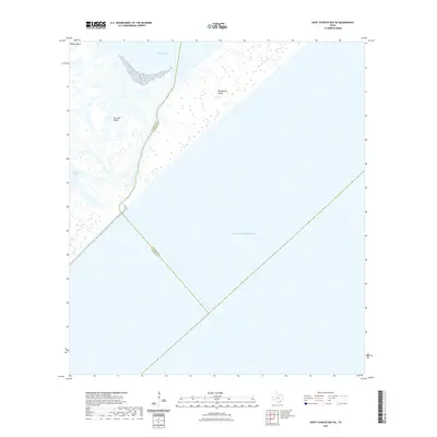
2022 Map of Saint Charles Bay SE
USGS Topo · Published 2022About this map
San Jose Island and Matagorda Island dominate this coastal survey at the intersection of Aransas and Calhoun counties. The map documents the dynamic interface between the Gulf of Mexico and the interior estuarine systems of the Texas barrier islands. The narrow passage near Mesquite Bay reveals the complex network of tidal wetlands and inlets that define this environment, including the marshy reaches of Vinson Slough and the isolated geography of Ballou Island. This map is primarily an exploration of maritime boundaries and coastal geomorphology, showing the precise county line as it bisects the open waters and low-lying landforms of the gulf coast.
Find a feature on this map
8 named features on this map. Tap any name to fly to it.
Don’t see what you’re looking for? This feature index may not catch every label — zoom into the map to look around manually.
Map Details
Editions of this 2022 Saint Charles Bay SE Map
This is the sole edition of this map. No revisions or reprints were ever made.
Other maps of this area

1950 · Corpus Christi
USGS Topo · 1:250,000

1951 · Allyns Bight
USGS Topo · 1:24,000

1952 · St. Charles Bay SW
USGS Topo · 1:24,000

1952 · St. Charles Bay
USGS Topo · 1:24,000

1952 · Mesquite Bay
USGS Topo · 1:24,000

1952 · Panther Point
USGS Topo · 1:24,000

1952 · St. Charles Bay SE
USGS Topo · 1:24,000

1953 · Beeville
USGS Topo · 1:250,000

1956 · Corpus Christi
USGS Topo · 1:250,000

1956 · Beeville
USGS Topo · 1:250,000