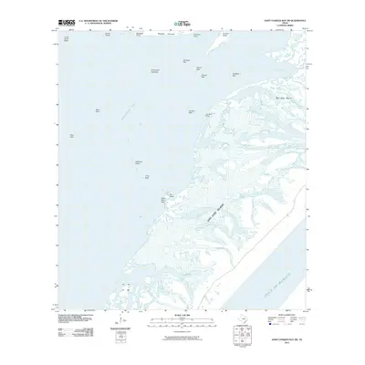
2010 Map of Saint Charles Bay SW
USGS Topo · Published 2010About this map
San Jose Island and the shallow reaches of Arkansas Bay dominate this coastal landscape, illustrating the complex estuarine environment of the Texas Gulf Coast. The transition from the open Gulf of Mexico across the barrier island leads into a network of marshy passages like Vinson Slough and sheltered waters such as Spalding Bight. This 2010 survey highlights a shoreline defined more by shifting oyster reefs and low-lying points than by human infrastructure. Notable landmarks include the named reefs that segment the bay, such as Long Reef and Mack Reef, which have long influenced local navigation and fishing. The proximity of the Blackjack Peninsula and several isolated landmasses like Deadman Island and Big Island suggests a dynamic coastal geomorphology shaped by tidal action and storm surges.
Find a feature on this map
25 named features on this map. Tap any name to fly to it.
Don’t see what you’re looking for? This feature index may not catch every label — zoom into the map to look around manually.
Map Details
Editions of this 2010 Saint Charles Bay SW Map
This is the sole edition of this map. No revisions or reprints were ever made.
Other maps of this area

1925 · Aransas Pass
USGS Topo · 1:62,500

1950 · Corpus Christi
USGS Topo · 1:250,000

1951 · Allyns Bight
USGS Topo · 1:24,000

1952 · St. Charles Bay SW
USGS Topo · 1:24,000

1952 · St. Charles Bay
USGS Topo · 1:24,000

1952 · Mesquite Bay
USGS Topo · 1:24,000

1952 · St. Charles Bay SE
USGS Topo · 1:24,000

1953 · Beeville
USGS Topo · 1:250,000

1954 · Rockport
USGS Topo · 1:62,500

1954 · Estes
USGS Topo · 1:24,000