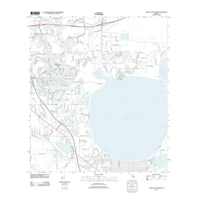
2012 Map of Saint Cloud North
USGS Topo · Published 2012About this map
East Lake Tohopekaliga dominates this landscape, its shoreline defining the development patterns of the early twenty-first century. The residential growth of Buenaventura Lakes shows a complex network of suburban streets and water-management features, including the Buena Ventura Lakes Wastewater Treatment Facility. To the north and east, the transition from dense housing to open land is marked by landmarks like Hillard Island and Mount Carmel Cem, alongside specialized aviation sites such as the East Lake Seaplane Base and Big Sky Airpark. Historical land use is visible in the named corridors like Partin Settlement Rd and the smaller, ecologically distinct waters of Fennel Slough and Lake Runnymede. This survey captures the region as it balanced expanding infrastructure with the preservation of its marshy lowlands and historic burial grounds like Barber Cem.
Find a feature on this map
210 named features on this map. Tap any name to fly to it.
Don’t see what you’re looking for? This feature index may not catch every label — zoom into the map to look around manually.
Map Details
Editions of this 2012 Saint Cloud North Map
This is the sole edition of this map. No revisions or reprints were ever made.
Other maps of this area

1953 · Lake Jessamine
USGS Topo · 1:24,000

1953 · St Cloud North
USGS Topo · 1:24,000

1953 · Narcoossee
USGS Topo · 1:24,000

1953 · St Cloud South
USGS Topo · 1:24,000

1953 · Lake Tohopekaliga
USGS Topo · 1:24,000

1953 · Ashton
USGS Topo · 1:24,000

1953 · Pine Castle
USGS Topo · 1:24,000

1953 · Kissimmee
USGS Topo · 1:24,000

1953 · Narcoossee NW
USGS Topo · 1:24,000

1955 · Orlando
USGS Topo · 1:250,000