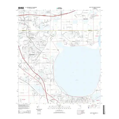
2015 Map of Saint Cloud North
USGS Topo · Published 2015About this map
E Lake Tohopekaliga dominates the central landscape of this Central Florida corridor, serving as a geographic anchor between the expanding residential footprints of Kissimmee and Saint Cloud. The map documents a highly developed suburban environment where the Florida Turnpike and Boggy Creek Rd facilitate movement between Orlando and its southern neighbors. Amidst the modern street grids of Buenaventura Lakes, older land markers remain, including the Mount Carmel Cem and Barber Cem. The drainage patterns and water management of the region are clearly visible through the Saint Cloud Canal and Partin-Canal, while the Florida National Scenic Trail traces a path through the wetlands near Fish Lake. This survey illustrates the intricate balance between rapid residential growth and the preserved natural basins of the Kissimmee River system.
Find a feature on this map
34 named features on this map. Tap any name to fly to it.
Don’t see what you’re looking for? This feature index may not catch every label — zoom into the map to look around manually.
Map Details
Editions of this 2015 Saint Cloud North Map
This is the sole edition of this map. No revisions or reprints were ever made.
Other maps of this area

1953 · Lake Jessamine
USGS Topo · 1:24,000

1953 · St Cloud North
USGS Topo · 1:24,000

1953 · Narcoossee
USGS Topo · 1:24,000

1953 · St Cloud South
USGS Topo · 1:24,000

1953 · Lake Tohopekaliga
USGS Topo · 1:24,000

1953 · Ashton
USGS Topo · 1:24,000

1953 · Pine Castle
USGS Topo · 1:24,000

1953 · Kissimmee
USGS Topo · 1:24,000

1953 · Narcoossee NW
USGS Topo · 1:24,000

1955 · Orlando
USGS Topo · 1:250,000