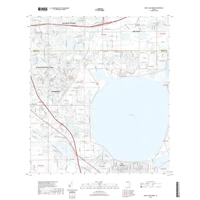
2018 Map of Saint Cloud North
USGS Topo · Published 2018About this map
E Lake Tohopekaliga dominates the southern landscape of this Central Florida corridor, its northern shoreline defining the development patterns of St. Cloud and southern Kissimmee. In the late 2010s, this region shows significant suburban expansion and institutional growth, anchored by the Univ of Central Florida College of Medicine in the northern Orlando section. The map documents a complex network of water management features, including the Saint Cloud Canal, Partin Canal, and Bass Slough, which navigate the low-lying terrain between established communities. Local history and genealogy are preserved in several burial grounds such as Osceola Memory Gardens Cemetery and the smaller Barber Cem. Farther north, the planned residential developments of Buenaventura Lakes and Meadow Woods illustrate the modern residential density expanding into former wetlands like Boggy Creek Swamp.
Find a feature on this map
214 named features on this map. Tap any name to fly to it.
Don’t see what you’re looking for? This feature index may not catch every label — zoom into the map to look around manually.
Map Details
Editions of this 2018 Saint Cloud North Map
This is the sole edition of this map. No revisions or reprints were ever made.
Other maps of this area

1953 · Lake Jessamine
USGS Topo · 1:24,000

1953 · St Cloud North
USGS Topo · 1:24,000

1953 · Narcoossee
USGS Topo · 1:24,000

1953 · St Cloud South
USGS Topo · 1:24,000

1953 · Lake Tohopekaliga
USGS Topo · 1:24,000

1953 · Ashton
USGS Topo · 1:24,000

1953 · Pine Castle
USGS Topo · 1:24,000

1953 · Kissimmee
USGS Topo · 1:24,000

1953 · Narcoossee NW
USGS Topo · 1:24,000

1955 · Orlando
USGS Topo · 1:250,000