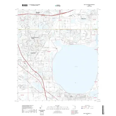
2021 Map of Saint Cloud North
USGS Topo · Published 2021About this map
East Lake Tohopekaliga dominates this landscape, its waters meeting the northern residential developments of St. Cloud and the eastern fringes of Kissimmee. In the north, the modern expansion of Orlando is evident, particularly with institutional landmarks like the University of Central Florida College of Medicine and the University of Florida Academic and Research Center near Boggy Creek Swamp.
Find a feature on this map
265 named features on this map. Tap any name to fly to it.
Don’t see what you’re looking for? This feature index may not catch every label — zoom into the map to look around manually.
Map Details
Editions of this 2021 Saint Cloud North Map
This is the sole edition of this map. No revisions or reprints were ever made.
Other maps of this area

1953 · Lake Jessamine
USGS Topo · 1:24,000

1953 · St Cloud North
USGS Topo · 1:24,000

1953 · Narcoossee
USGS Topo · 1:24,000

1953 · St Cloud South
USGS Topo · 1:24,000

1953 · Lake Tohopekaliga
USGS Topo · 1:24,000

1953 · Ashton
USGS Topo · 1:24,000

1953 · Pine Castle
USGS Topo · 1:24,000

1953 · Kissimmee
USGS Topo · 1:24,000

1953 · Narcoossee NW
USGS Topo · 1:24,000

1955 · Orlando
USGS Topo · 1:250,000