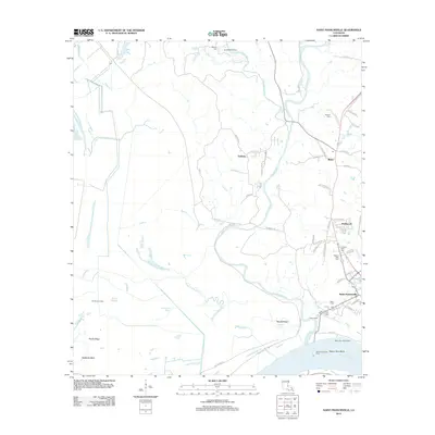
2012 Map of Saint Francisville
USGS Topo · Published 2012About this map
Saint Francisville anchors this West Feliciana Parish landscape, situated where the high ground meets the winding Mississippi River. The town's historical depth is reflected in several significant burial sites, including Grace Cem, Our Lady of Mount Carmel Cem, and the Hebrew Rest Cem. To the north, the geography is defined by the braided paths of Bayou Sara and its tributaries like Little Bayou Sara, which cut through the terrain toward smaller settlements at Bains and Solitude. The map details a transition from the structured street plan of the parish seat to the agricultural and wooded expanses of Peach Ridge and Hardwood. Engineering works along the river, such as the Bayou Sara Revetment and the Saint Francisville Ferry crossing at Bayou Sara Bend, underscore the ongoing importance of the waterway to local infrastructure and transport.
Find a feature on this map
71 named features on this map. Tap any name to fly to it.
Don’t see what you’re looking for? This feature index may not catch every label — zoom into the map to look around manually.
Map Details
Editions of this 2012 Saint Francisville Map
This is the sole edition of this map. No revisions or reprints were ever made.
Other maps of this area

1906 · Bayou Sara
USGS Topo · 1:125,000

1939 · St. Francisville
USGS Topo · 1:62,500

1939 · Fordoche
USGS Topo · 1:62,500

1941 · Batchelor
USGS Topo · 1:62,500

1953 · New Roads
USGS Topo · 1:24,000

1954 · Port Hudson
USGS Topo · 1:24,000

1954 · Elm Park
USGS Topo · 1:24,000

1954 · Baton Rouge
USGS Topo · 1:250,000

1955 · Fordoche
USGS Topo · 1:62,500

1955 · Batchelor
USGS Topo · 1:62,500
Featured Places
- Saint Francisville, St. Francisville
- St. Francisville, LA
- Bains, LA
- Solitude, LA
- Pointe Coupee Parish, LA