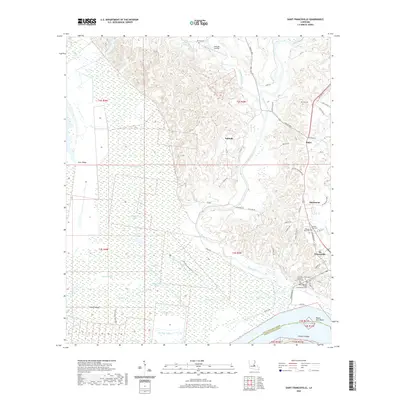
2020 Map of Saint Francisville
USGS Topo · Published 2020About this map
St. Francisville sits perched above a dramatic bend in the Mississippi River, where the high ground of Cane Ridge and Peach Ridge meets the vast expanse of the Tunica Swamp. This 2020 survey illustrates a landscape defined by the winding course of Bayou Sara and its numerous tributaries, such as Little Bayou Sara and Alexander Cr. The historical significance of the parish seat is evident in the presence of the West Feliciana Parish Courthouse Annex and several established cemeteries including Hebrew Rest Cem and Our Lady of Mount Carmel Cem. Moving north from the river, the terrain shifts into the upland communities of Hardwood, Bains, and Solitude. The map traces modern infrastructure alongside historic routes like Tunica Trace, while recreational paths like the Blackfork Hiking Trail wind through the wetlands near Blackfork Lake and Davis Lake.
Find a feature on this map
98 named features on this map. Tap any name to fly to it.
Don’t see what you’re looking for? This feature index may not catch every label — zoom into the map to look around manually.
Map Details
Editions of this 2020 Saint Francisville Map
This is the sole edition of this map. No revisions or reprints were ever made.
Other maps of this area

1906 · Bayou Sara
USGS Topo · 1:125,000

1939 · St. Francisville
USGS Topo · 1:62,500

1939 · Fordoche
USGS Topo · 1:62,500

1941 · Batchelor
USGS Topo · 1:62,500

1953 · New Roads
USGS Topo · 1:24,000

1954 · Port Hudson
USGS Topo · 1:24,000

1954 · Elm Park
USGS Topo · 1:24,000

1954 · Baton Rouge
USGS Topo · 1:250,000

1955 · Fordoche
USGS Topo · 1:62,500

1955 · Batchelor
USGS Topo · 1:62,500
Featured Places
- Saint Francisville, St. Francisville
- St. Francisville, LA
- Bains, LA
- Solitude, LA
- Pointe Coupee Parish, LA