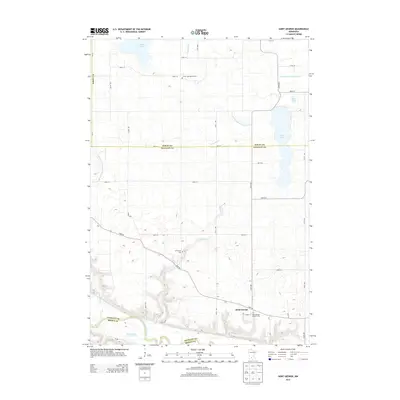
2013 Map of Saint George
USGS Topo · Published 2013About this map
The Saint George settlement sits just north of the bluff line overlooking the wide valley of the Minnesota River, which forms the southern boundary of this region. The landscape is defined by the transition from the flat agricultural tableland of Sibley Co and Nicollet Co into the more complex river drainage system. Water management is a central theme of the local terrain, evidenced by extensive engineered waterways such as Judicial Ditch Number One and County Ditch Number Four A. Local heritage is preserved in several rural burial grounds, including the Saint George Catholic Cem near the town site, and the Clear Lake Baptist Cem located further north. Significant natural water bodies like Swan Lake and Clear Lake dot the northern reaches, while the Minnesota River corridor features the distinct Horseshoe Lake, reflecting the shifting historical path of the riverbed.
Find a feature on this map
30 named features on this map. Tap any name to fly to it.
Don’t see what you’re looking for? This feature index may not catch every label — zoom into the map to look around manually.
Map Details
Editions of this 2013 Saint George Map
This is the sole edition of this map. No revisions or reprints were ever made.
Other maps of this area

1953 · New Ulm
USGS Topo · 1:250,000

1957 · New Ulm
USGS Topo · 1:250,000

1958 · New Ulm
USGS Topo · 1:250,000

1958 · Winthrop
USGS Topo · 1:62,500

1964 · New Ulm
USGS Topo · 1:24,000

1964 · Fairfax
USGS Topo · 1:24,000

1964 · Sleepy Eye NW
USGS Topo · 1:24,000

1964 · Sleepy Eye
USGS Topo · 1:24,000

1964 · Essig
USGS Topo · 1:24,000

1964 · Lafayette
USGS Topo · 1:24,000