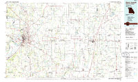
1986 Map of Saint Joseph
USGS Topo · Published 1986About this map
Saint Joseph serves as the focal point of this Northwest Missouri region, situated where the Missouri River bends sharply near the Kansas border. In the mid-1980s, the city is a hub of institutional and recreational landmarks, including the campus of Missouri Western State College and the St Joseph State Hospital. The landscape is defined by the convergence of major waterways such as the One Hundred and Two River and the Platte River, which nourish fertile lowlands like Burr Oak Bottom and Gladden Bottom.
Find a feature on this map
136 named features on this map. Tap any name to fly to it.
Don’t see what you’re looking for? This feature index may not catch every label — zoom into the map to look around manually.
Map Details
Editions of this 1986 Saint Joseph Map
2 editions found
Other maps of this area

1885 · Atchison
USGS Topo · 1:125,000

1886 · Oskaloosa
USGS Topo · 1:125,000

1888 · Oskaloosa
USGS Topo · 1:125,000

1888 · Atchison
USGS Topo · 1:125,000

1889 · Lexington
USGS Topo · 1:125,000

1890 · Kansas City
USGS Topo · 1:125,000

1893 · Atchison
USGS Topo · 1:125,000

1894 · Kansas City
USGS Topo · 1:125,000

1894 · Independence
USGS Topo · 1:125,000

1894 · Oskaloosa
USGS Topo · 1:125,000