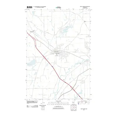
2010 Map of Saint Joseph
USGS Topo · Published 2010About this map
Saint Joseph serves as the central hub of this Stearns County landscape, where the Sauk River and its various tributaries define the local geography. The area's spiritual and community history is anchored by several burial grounds, including the Saint Joseph Cemetery, Monastic Cemetery, and the more remote Stranger Cemetery. To the northwest, Collegeville remains a significant settlement, home to the Collegeville Post Office and situated near the North Fork Watab River. This 2010 survey shows the integration of modern recreation with the historical rail corridor through the Lake Wobegon Trl, which follows a path through the heart of the region. The landscape is also marked by early engineering efforts like County Ditch Number Seventeen, reflecting long-standing water management in the drainage basins of Watab Lake and Pleasant Lake.
Find a feature on this map
41 named features on this map. Tap any name to fly to it.
Don’t see what you’re looking for? This feature index may not catch every label — zoom into the map to look around manually.
Map Details
Editions of this 2010 Saint Joseph Map
This is the sole edition of this map. No revisions or reprints were ever made.
Other maps of this area

1950 · St. Cloud
USGS Topo · 1:62,500

1951 · Annandale
USGS Topo · 1:62,500

1953 · Saint Cloud
USGS Topo · 1:250,000

1957 · Saint Cloud
USGS Topo · 1:250,000

1958 · Saint Cloud
USGS Topo · 1:250,000

1965 · St Stephen
USGS Topo · 1:24,000

1965 · Holdingford
USGS Topo · 1:24,000

1965 · St Joseph
USGS Topo · 1:24,000

1965 · Avon
USGS Topo · 1:24,000

1967 · Cold Spring
USGS Topo · 1:24,000