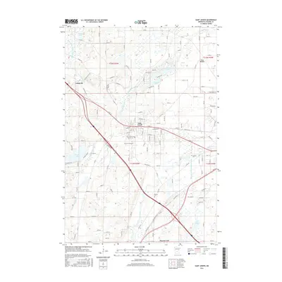
2016 Map of Saint Joseph
USGS Topo · Published 2016About this map
Saint Joseph and the Coll of Saint Benedict anchor this central Minnesota landscape, where the Sauk River and the branching Watab River wind through the terrain. The map details a transition from the structured street grids of the town to the surrounding rural reaches of Stearns County, including the small settlement of Collegeville to the west. A cluster of local history is preserved in the numerous burial grounds documented here, such as the Saint Joseph Cem, Monastic Cem, and the more remote Stranger Cem near County Ditch Number Seventeen. Water defines much of the area's character, with named bodies like Rossier Lake, Kraemer Lake, and Pleasant Lake providing natural landmarks. The map also traces modern transport corridors like Co Rd 75 and Old Hwy 52 as they navigate the region's complex system of creeks and drainage ditches.
Find a feature on this map
78 named features on this map. Tap any name to fly to it.
Don’t see what you’re looking for? This feature index may not catch every label — zoom into the map to look around manually.
Map Details
Editions of this 2016 Saint Joseph Map
This is the sole edition of this map. No revisions or reprints were ever made.
Other maps of this area

1950 · St. Cloud
USGS Topo · 1:62,500

1951 · Annandale
USGS Topo · 1:62,500

1953 · Saint Cloud
USGS Topo · 1:250,000

1957 · Saint Cloud
USGS Topo · 1:250,000

1958 · Saint Cloud
USGS Topo · 1:250,000

1965 · St Stephen
USGS Topo · 1:24,000

1965 · Holdingford
USGS Topo · 1:24,000

1965 · St Joseph
USGS Topo · 1:24,000

1965 · Avon
USGS Topo · 1:24,000

1967 · Cold Spring
USGS Topo · 1:24,000