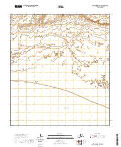
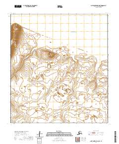
2020 Map of Saint Lawrence C-4 SW
USGS Topo · Published 2020About this map
Bering Sea waters dominate the southern and central reaches of this coastal portion of Saint Lawrence Island. The shoreline is defined by the prominent Impaghuk Point and the sheltered waters of Powooiliak Bay in the southwest. This geographic study, compiled by the U.S. Geological Survey, reflects the island's remote topography through the Public Land Survey System, specifically marking divisions within t23s r64w, t23s r63w, and t24s r64w. The landscape transition from the open sea to the inland coastal plains is captured with precise contour data from the National Elevation Dataset, providing a specialized record of the island's maritime boundary and coastal features.
Find a feature on this map
7 named features on this map. Tap any name to fly to it.
Don’t see what you’re looking for? This feature index may not catch every label — zoom into the map to look around manually.
Map Details
Editions of this 2020 Saint Lawrence C-4 SW Map
This is the sole edition of this map. No revisions or reprints were ever made.
Other maps of this area

1948 · St Lawrence
USGS Topo · 1:250,000

1949 · St Lawrence
USGS Topo · 1:250,000

1964 · St Lawrence
USGS Topo · 1:250,000

2020 · Saint Lawrence C-4 NE
USGS Topo · 1:25,000

2020 · Saint Lawrence C-4 SE
USGS Topo · 1:25,000
2020 · Saint Lawrence C-4 NW
USGS Topo · 1:25,000
2020 · Saint Lawrence C-5 SE
USGS Topo · 1:25,000
2020 · Saint Lawrence B-4 NE
USGS Topo · 1:25,000
2020 · Saint Lawrence C-5 NE
USGS Topo · 1:25,000