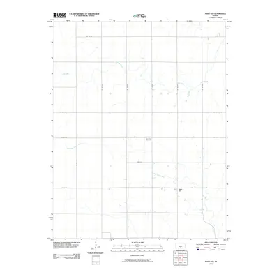
2009 Map of Saint Leo
USGS Topo · Published 2009About this map
Saint Leo sits in the southeastern portion of this Kingman County landscape, serving as a focal point for the surrounding rural grid. The terrain is defined by the gradual southward flow of the North Fork Chikaskia River and Painter Creek, which cut through a strictly organized system of section roads. The placement of West Point Cemetery in the center of the quadrangle highlights the historical roots of this farming community. This survey from the late 2000s illustrates the persistent agrarian character of the region, where the primary infrastructure consists of long gravel and paved arteries like SW 180 Ave and SE 80th St that connect isolated homesteads and farmland.
Find a feature on this map
17 named features on this map. Tap any name to fly to it.
Don’t see what you’re looking for? This feature index may not catch every label — zoom into the map to look around manually.
Map Details
Editions of this 2009 Saint Leo Map
This is the sole edition of this map. No revisions or reprints were ever made.
Other maps of this area

1889 · Anthony
USGS Topo · 1:125,000

1891 · Medicine Lodge
USGS Topo · 1:125,000

1891 · Anthony
USGS Topo · 1:125,000

1892 · Kingman
USGS Topo · 1:125,000

1892 · Pratt
USGS Topo · 1:125,000

1893 · Medicine Lodge
USGS Topo · 1:125,000

1894 · Kingman
USGS Topo · 1:125,000

1894 · Pratt
USGS Topo · 1:125,000

1955 · Pratt
USGS Topo · 1:250,000

1959 · Pratt
USGS Topo · 1:250,000