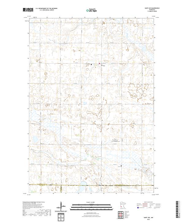
2022 Map of Saint Leo
USGS Topo · Published 2022About this map
Saint Leo anchors this agricultural landscape in Yellow Medicine County, centered on the intersection of Co Hwy 3 and 300th St. This area reflects the organized grid of the Public Land Survey System, where sections are clearly defined by a network of gravel and paved routes like 230th Ave and 320th St. The terrain is characterized by prairie wetlands and slow-moving drainages, including the meandering path of Mud Cr and the waters of Lanners Lake in the northeast corner. Cultural sites of significance to genealogists include the Saint Leo Cem and the more southern Burton Cem near the borders of Lincoln and Lyon counties. The presence of Congers Marsh and several unnamed depressions suggests a landscape where water management and drainage are central to the local farming economy.
Find a feature on this map
43 named features on this map. Tap any name to fly to it.
Don’t see what you’re looking for? This feature index may not catch every label — zoom into the map to look around manually.
Map Details
Editions of this 2022 Saint Leo Map
This is the sole edition of this map. No revisions or reprints were ever made.
Other maps of this area

1953 · Watertown
USGS Topo · 1:250,000

1953 · New Ulm
USGS Topo · 1:250,000

1957 · New Ulm
USGS Topo · 1:250,000

1958 · New Ulm
USGS Topo · 1:250,000

1958 · Watertown
USGS Topo · 1:250,000

1965 · Boyd
USGS Topo · 1:24,000

1967 · New Ulm
USGS Topo · 1:250,000

1967 · Dawson SW
USGS Topo · 1:24,000

1967 · Minneota
USGS Topo · 1:24,000

1967 · Porter
USGS Topo · 1:24,000