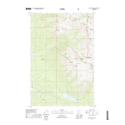
2020 Map of Saint Marys Lake
USGS Topo · Published 2020About this map
The Mission Range forms the spine of this landscape along the boundary of Lake and Missoula counties. High-elevation hydrology is a defining characteristic, with the Mission Reservoir and Saint Marys Lake occupying the lower valleys, while a network of glacial tarns and cascades like Lake of the Stars, Lucifer Lake, and Elizabeth Falls are tucked into the upper basins. Dramatic vertical relief is marked by landmarks such as The Garden Wall, Glacier Peaks, and the twin summits of West Saint Marys Peak and East Saint Marys Peak. The eastern portion of the sheet is protected as part of the Flathead National Forest, showing a wilderness area defined by steep drainages like Mission Cr and Ashley Cr that flow through complex terrain designated by various private and public land blocks.
Find a feature on this map
63 named features on this map. Tap any name to fly to it.
Don’t see what you’re looking for? This feature index may not catch every label — zoom into the map to look around manually.
Map Details
Editions of this 2020 Saint Marys Lake Map
This is the sole edition of this map. No revisions or reprints were ever made.
Other maps of this area

1921 · Elbow Lake
USGS Topo · 1:125,000

1955 · Choteau
USGS Topo · 1:250,000

1956 · Wallace
USGS Topo · 1:250,000

1957 · Choteau
USGS Topo · 1:250,000

1958 · Choteau
USGS Topo · 1:250,000

1959 · Arlee
USGS Topo · 1:62,500

1960 · Wallace
USGS Topo · 1:250,000

1962 · Choteau
USGS Topo · 1:250,000

1964 · Fort Connah
USGS Topo · 1:24,000

1964 · Saint Ignatius
USGS Topo · 1:24,000