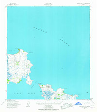
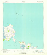
1952 Map of Saint Michael C-1
USGS Topo · Published 1967About this map
Stuart Island and Saint Michael Island anchor this coastal survey, where the waters of Norton Sound meet a landscape of tidal canals and low peaks. The settlement of Stebbins sits on the northwestern edge of Saint Michael Island, positioned near a landing strip and a collection of cabins along the shore. This area reflects a critical point of maritime and aerial transit in the early 1950s, serving as a hub between North Bay and the open sound.
Find a feature on this map
21 named features on this map. Tap any name to fly to it.
Don’t see what you’re looking for? This feature index may not catch every label — zoom into the map to look around manually.
Map Details
Editions of this 1952 Saint Michael C-1 Map
2 editions found
Other maps of this area

1951 · Unalakleet
USGS Topo · 1:250,000

1951 · St Michael
USGS Topo · 1:250,000
1952 · Saint Michael B-2
USGS Topo · 1:63,360
1952 · Saint Michael C-1
USGS Topo · 1:63,360
1952 · Saint Michael C-2
USGS Topo · 1:63,360

1952 · Saint Michael B-1
USGS Topo · 1:63,360

1952 · Unalakleet B-6
USGS Topo · 1:63,360

1952 · St Michael
USGS Topo · 1:250,000

1952 · Unalakleet
USGS Topo · 1:250,000

1964 · St. Michael
USGS Topo · 1:250,000