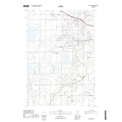
2019 Map of Saint Michael
USGS Topo · Published 2019About this map
The Crow River snakes along the southeastern border of Wright County in this modern survey, defining the boundary with Hennepin County near Hanover. This landscape is characterized by a dense concentration of glacial lakes, including the large Pelican Lake to the northwest and the twin basins of Lake Charlotte and Lake Martha in the south. The expanding residential corridors of St. Michael and Albertville are prominent, showing a network of modern thoroughfares like St Michael Pkwy and Frankfort Pkwy NE. Local heritage is well-preserved in several dedicated sites, such as the Saint Michael Cem and the Salem Lutheran Church Cem further south in Greenfield. Smaller water bodies like Gonzo Lake and Lake Wilhelm are scattered throughout the township lines, illustrating the classic lake-country topography of the region.
Find a feature on this map
94 named features on this map. Tap any name to fly to it.
Don’t see what you’re looking for? This feature index may not catch every label — zoom into the map to look around manually.
Map Details
Editions of this 2019 Saint Michael Map
This is the sole edition of this map. No revisions or reprints were ever made.
Other maps of this area

1909 · Rockford
USGS Topo · 1:62,500

1953 · Stillwater
USGS Topo · 1:250,000

1955 · Stillwater
USGS Topo · 1:250,000

1958 · Stillwater
USGS Topo · 1:250,000

1958 · Rockford
USGS Topo · 1:62,500

1958 · Buffalo
USGS Topo · 1:62,500

1961 · Big Lake
USGS Topo · 1:24,000

1961 · Elk River
USGS Topo · 1:24,000

1961 · Monticello
USGS Topo · 1:24,000

1961 · Monticello
USGS Topo · 1:62,500