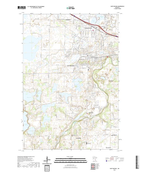
2022 Map of Saint Michael
USGS Topo · Published 2022About this map
St. Michael and Albertville serve as central hubs in this modern topographic study of eastern Wright County. The landscape is defined by its intricate glacial hydrology, featuring numerous water bodies such as Pelican Lake, Beebe Lake, and Lake Charlotte. The Crow River and its North Fork mark the transition between Wright and Hennepin counties, where small settlements like Hanover and Greenfield sit along the winding riverbanks. Genealogists can locate several historic burial sites, including the Saint Michael Cem Old and Saint Michael Cem New, along with the Saint Albert's Catholic Cem further north. The map documents a dense network of township roads and county highways that stitch together these growing communities while preserving the surrounding wetlands and lakes like Uhl Lake and Ganz Lake.
Find a feature on this map
94 named features on this map. Tap any name to fly to it.
Don’t see what you’re looking for? This feature index may not catch every label — zoom into the map to look around manually.
Map Details
Editions of this 2022 Saint Michael Map
This is the sole edition of this map. No revisions or reprints were ever made.
Other maps of this area

1909 · Rockford
USGS Topo · 1:62,500

1953 · Stillwater
USGS Topo · 1:250,000

1955 · Stillwater
USGS Topo · 1:250,000

1958 · Stillwater
USGS Topo · 1:250,000

1958 · Rockford
USGS Topo · 1:62,500

1958 · Buffalo
USGS Topo · 1:62,500

1961 · Big Lake
USGS Topo · 1:24,000

1961 · Elk River
USGS Topo · 1:24,000

1961 · Monticello
USGS Topo · 1:24,000

1961 · Monticello
USGS Topo · 1:62,500