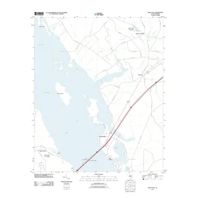
2011 Map of Saint Paul
USGS Topo · Published 2011About this map
Lake Marion dominates the western landscape of this South Carolina quadrangle, shaping the life and geography of Clarendon County. The shoreline is punctuated by several access points and small settlements, including Adams Landing, Lewis Landing, and Pinkey Landing, reflecting the area's orientation toward the water. To the east, the community of Saint Paul sits near the intersection of several local routes, while Belser Crossroads serves as a northern waypoint near Stukes Pond.
Find a feature on this map
48 named features on this map. Tap any name to fly to it.
Don’t see what you’re looking for? This feature index may not catch every label — zoom into the map to look around manually.
Map Details
Editions of this 2011 Saint Paul Map
This is the sole edition of this map. No revisions or reprints were ever made.
Other maps of this area

1920 · Eutawville
USGS Topo · 1:48,000

1920 · Bowman
USGS Topo · 1:48,000

1921 · Bowman
USGS Topo · 1:62,500

1921 · Eutawville
USGS Topo · 1:62,500

1943 · Bowman
USGS Topo · 1:62,500

1943 · Orangeburg
USGS Topo · 1:125,000

1943 · Eutawville
USGS Topo · 1:62,500

1946 · Elloree
USGS Topo · 1:62,500

1954 · Augusta
USGS Topo · 1:250,000

1957 · Augusta
USGS Topo · 1:250,000