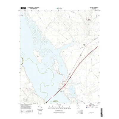
2017 Map of Saint Paul
USGS Topo · Published 2017About this map
Lake Marion and its expansive wetlands dominate this South Carolina landscape, defining the convergence of Clarendon, Calhoun, and Orangeburg counties. The vast waters of Cantey Bay and Doctor Bay illustrate the intricate shoreline of the reservoir, punctuated by landmarks such as Persanti Island and the elevated reach of Paradise Point. This mid-2010s survey captures the transport corridor crossing the lake via the Francis Marion Bridge and the W J Gooding Bridge, connecting the rural settlements of Saint Paul and Belser Crossroads to the surrounding region.
Find a feature on this map
57 named features on this map. Tap any name to fly to it.
Don’t see what you’re looking for? This feature index may not catch every label — zoom into the map to look around manually.
Map Details
Editions of this 2017 Saint Paul Map
This is the sole edition of this map. No revisions or reprints were ever made.
Other maps of this area

1920 · Eutawville
USGS Topo · 1:48,000

1920 · Bowman
USGS Topo · 1:48,000

1921 · Bowman
USGS Topo · 1:62,500

1921 · Eutawville
USGS Topo · 1:62,500

1943 · Bowman
USGS Topo · 1:62,500

1943 · Orangeburg
USGS Topo · 1:125,000

1943 · Eutawville
USGS Topo · 1:62,500

1946 · Elloree
USGS Topo · 1:62,500

1954 · Augusta
USGS Topo · 1:250,000

1957 · Augusta
USGS Topo · 1:250,000