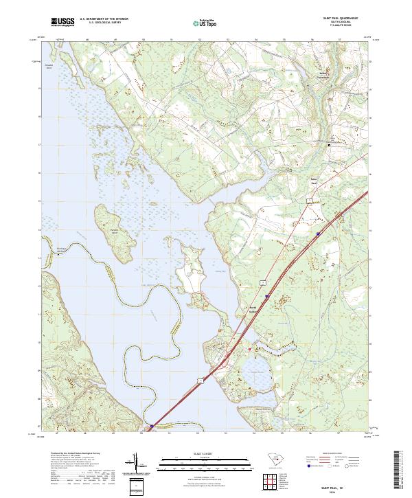
2024 Map of Saint Paul
USGS Topo · Published 2024About this map
Lake Marion and the Santee River dominate this modern landscape where Clarendon and Orangeburg counties meet. The protected wetlands of the Santee National Wildlife Refuge preserve significant reaches of the shoreline, including Cantey Bay and the swampy environs of Dingle Pond. These areas contrast with the established agricultural and residential patterns found further inland. Local history is anchored by the small community of Saint Paul and the rural intersection at Belser Crossroads. The northern portion of the map is defined by family-named roads like Governor Richardson Rd and Mathis Rd, reflecting deep-rooted land ownership in the region. Genealogists may find interest in the Liberty Hill Church Graveyard, situated near the eastern edge of the quadrangle. The map also traces modern infrastructure, including the path of Rte 76 as it passes through the timbered and farmed tracts north of the Santee basin.
Find a feature on this map
70 named features on this map. Tap any name to fly to it.
Don’t see what you’re looking for? This feature index may not catch every label — zoom into the map to look around manually.
Map Details
Editions of this 2024 Saint Paul Map
This is the sole edition of this map. No revisions or reprints were ever made.
Other maps of this area

1920 · Eutawville
USGS Topo · 1:48,000

1920 · Bowman
USGS Topo · 1:48,000

1921 · Bowman
USGS Topo · 1:62,500

1921 · Eutawville
USGS Topo · 1:62,500

1943 · Bowman
USGS Topo · 1:62,500

1943 · Orangeburg
USGS Topo · 1:125,000

1943 · Eutawville
USGS Topo · 1:62,500

1946 · Elloree
USGS Topo · 1:62,500

1954 · Augusta
USGS Topo · 1:250,000

1957 · Augusta
USGS Topo · 1:250,000