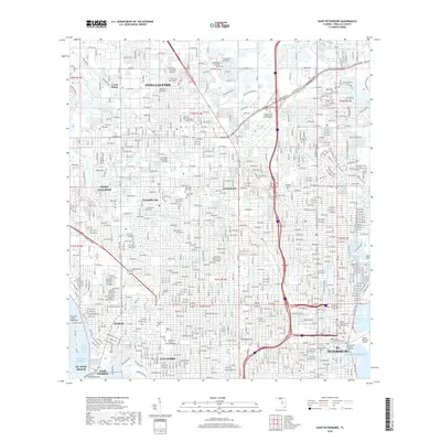
2018 Map of Saint Petersburg
USGS Topo · Published 2018About this map
Pinellas Park and the burgeoning suburban core of Pinellas County are defined by a dense grid of residential streets and essential community institutions in this 2018 survey. The landscape is characterized by its numerous memorial grounds, including Memorial Park Cem, Sunnyside Cem, and Royal Palm Cem, which serve as significant landmarks for genealogists and local historians. To the south, the map details the urban layout of St. Petersburg, showing its proximity to Tampa Bay and the specialized training facilities at Loraines Acad Inc.
Find a feature on this map
61 named features on this map. Tap any name to fly to it.
Don’t see what you’re looking for? This feature index may not catch every label — zoom into the map to look around manually.
Map Details
Editions of this 2018 Saint Petersburg Map
This is the sole edition of this map. No revisions or reprints were ever made.
Other maps of this area

1921 · Sand Key
USGS Topo · 1:62,500

1921 · Fort De Soto
USGS Topo · 1:62,500

1921 · St Petersburg
USGS Topo · 1:62,500

1942 · Cockroach Bay
USGS Topo · 1:31,680

1943 · St Petersburg
USGS Topo · 1:31,680

1943 · Gandy Bridge
USGS Topo · 1:31,680

1943 · Pass-A-Grille
USGS Topo · 1:31,680

1943 · Bay Pines
USGS Topo · 1:31,680

1943 · Safety Harbor
USGS Topo · 1:31,680

1943 · Port Tampa
USGS Topo · 1:31,680