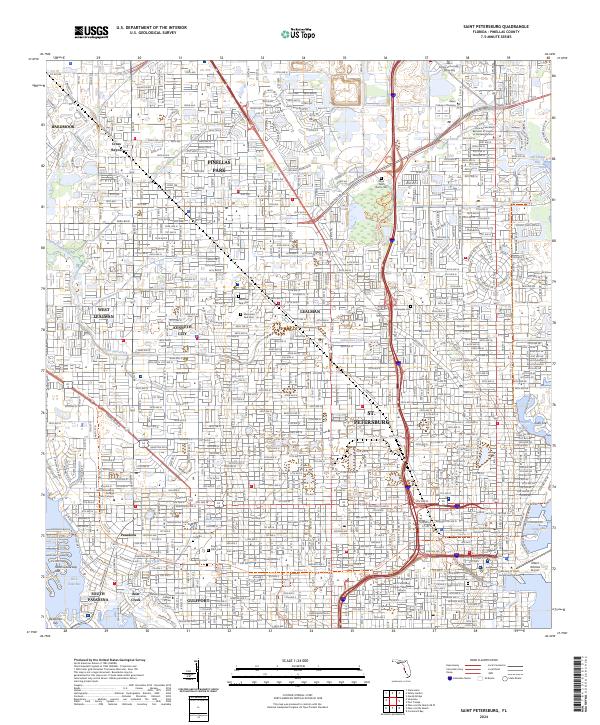
2024 Map of Saint Petersburg
USGS Topo · Published 2024About this map
St. Petersburg and its neighboring communities are shown in exhaustive detail across this contemporary survey of the lower Pinellas peninsula. The map captures the high-density urban grid stretching from the western shores of Boca Ciega Bay to the eastern docks of Tampa Bay and Old Tampa Bay. This coastal landscape is defined by its educational and civic institutions, including the University of South Florida Saint Petersburg and the Saint Petersburg Judicial Building.
Find a feature on this map
49 named features on this map. Tap any name to fly to it.
Don’t see what you’re looking for? This feature index may not catch every label — zoom into the map to look around manually.
Map Details
Editions of this 2024 Saint Petersburg Map
This is the sole edition of this map. No revisions or reprints were ever made.
Other maps of this area

1921 · Sand Key
USGS Topo · 1:62,500

1921 · Fort De Soto
USGS Topo · 1:62,500

1921 · St Petersburg
USGS Topo · 1:62,500

1942 · Cockroach Bay
USGS Topo · 1:31,680

1943 · St Petersburg
USGS Topo · 1:31,680

1943 · Gandy Bridge
USGS Topo · 1:31,680

1943 · Pass-A-Grille
USGS Topo · 1:31,680

1943 · Bay Pines
USGS Topo · 1:31,680

1943 · Safety Harbor
USGS Topo · 1:31,680

1943 · Port Tampa
USGS Topo · 1:31,680