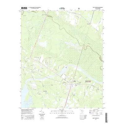
2017 Map of Saint Stephen
USGS Topo · Published 2017About this map
Saint Stephen serves as the primary hub in this Lowcountry landscape, situated where the boundary of the Francis Marion National Forest meets the developed corridors of Berkeley County. The mapping reveals a transition from the managed timberlands and swamps of the national forest to the residential and industrial clusters of Russellville. This area is defined by its complex hydrology, with the Santee River winding along the border with Williamsburg County, complemented by numerous drainage systems like Halfway Swamp and Walker Swamp. Historical footprints remain visible through several family and community burial grounds, including the Oldfield Plantation Cem and Keller Cem. The infrastructure of the era is marked by the presence of Lake Moultrie at the southwestern edge and the crossing at Murrays Ferry Bridge, illustrating the long-standing importance of river navigation and water management in this part of South Carolina.
Find a feature on this map
86 named features on this map. Tap any name to fly to it.
Don’t see what you’re looking for? This feature index may not catch every label — zoom into the map to look around manually.
Map Details
Editions of this 2017 Saint Stephen Map
This is the sole edition of this map. No revisions or reprints were ever made.
Other maps of this area

1920 · Chicora
USGS Topo · 1:48,000

1920 · Manning
USGS Topo · 1:48,000

1921 · Chicora
USGS Topo · 1:62,500

1921 · Manning
USGS Topo · 1:62,500

1943 · Chicora
USGS Topo · 1:62,500

1943 · Bonneau
USGS Topo · 1:62,500

1944 · Manning
USGS Topo · 1:62,500

1946 · Kingstree
USGS Topo · 1:62,500

1949 · Georgetown
USGS Topo · 1:250,000

1954 · Augusta
USGS Topo · 1:250,000