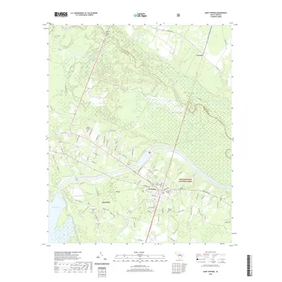
2020 Map of Saint Stephen
USGS Topo · Published 2020About this map
St. Stephen serves as a central hub in this corner of the Lowcountry, situated near the headwaters of Lake Moultrie and the sprawling wetlands of Halfway Swamp. The landscape is defined by the sharp boundary between Williamsburg Co and Berkeley Co, where the Santee River snakes eastward. This 2020 record captures a mix of timberland and established rural communities, with the Francis Marion National Forest occupying the southeastern quadrant. The map is particularly detailed regarding local genealogy, noting several burial grounds such as the Oldfield Plantation Cem and Sunset Memorial Cem. Transportation patterns are anchored by the rail corridor passing through Gourdin and the grid of residential streets in Russellville. Large topographical features like Big Bay emphasize the low-lying, water-dominant character of this South Carolina region.
Find a feature on this map
85 named features on this map. Tap any name to fly to it.
Don’t see what you’re looking for? This feature index may not catch every label — zoom into the map to look around manually.
Map Details
Editions of this 2020 Saint Stephen Map
This is the sole edition of this map. No revisions or reprints were ever made.
Other maps of this area

1920 · Chicora
USGS Topo · 1:48,000

1920 · Manning
USGS Topo · 1:48,000

1921 · Chicora
USGS Topo · 1:62,500

1921 · Manning
USGS Topo · 1:62,500

1943 · Chicora
USGS Topo · 1:62,500

1943 · Bonneau
USGS Topo · 1:62,500

1944 · Manning
USGS Topo · 1:62,500

1946 · Kingstree
USGS Topo · 1:62,500

1949 · Georgetown
USGS Topo · 1:250,000

1954 · Augusta
USGS Topo · 1:250,000