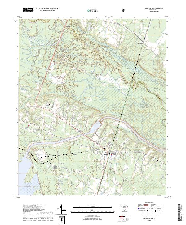
2024 Map of Saint Stephen
USGS Topo · Published 2024About this map
St. Stephen and Russellville sit at the edge of the Santee River basin, anchored by a deep network of family and community burial grounds. This modern survey details a landscape where the Santee River and Lake Moultrie define the northern and southern limits of the terrain. The presence of Saint Stephens Church Graveyard and the Oldfield Plantation Cem provides essential spatial context for genealogists tracing ancestral roots in this corner of Berkeley County. Much of the eastern portion of the map is occupied by the protected lands of the Francis Marion National Forest, where smaller water bodies like Kelley Branch and Ponteaux Branch drain into the swampy lowlands. To the north, the historic river crossing at Murrays Ferry remains a key geographical marker near the border with Williamsburg County, while internal drainage is managed by Crawl Creek and Halfway Swamp.
Find a feature on this map
95 named features on this map. Tap any name to fly to it.
Don’t see what you’re looking for? This feature index may not catch every label — zoom into the map to look around manually.
Map Details
Editions of this 2024 Saint Stephen Map
This is the sole edition of this map. No revisions or reprints were ever made.
Other maps of this area

1920 · Chicora
USGS Topo · 1:48,000

1920 · Manning
USGS Topo · 1:48,000

1921 · Chicora
USGS Topo · 1:62,500

1921 · Manning
USGS Topo · 1:62,500

1943 · Chicora
USGS Topo · 1:62,500

1943 · Bonneau
USGS Topo · 1:62,500

1944 · Manning
USGS Topo · 1:62,500

1946 · Kingstree
USGS Topo · 1:62,500

1949 · Georgetown
USGS Topo · 1:250,000

1954 · Augusta
USGS Topo · 1:250,000