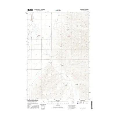
2017 Map of Saint Xavier
USGS Topo · Published 2017About this map
Saint Xavier serves as the focal point of this Big Horn County landscape, where the Bighorn River flows past intricate irrigation systems essential to local agriculture. The Big Horn Canal and Soap Cr Ditch reveal the deliberate management of water in this semi-arid region, supporting the valley's productivity. Cultural and family history centers on the Saint Xavier Catholic Mission Cem, a significant site reflecting the area's mission history and community roots. The terrain is defined by a series of distinct drainages such as Saint Xavier Coulee, Del Howe Coulee, and the curiously named East Dipping Vat Coulee, while the Mission Buttes rise to the east. These geological features, combined with local routes like Pryor Cutoff Rd and Good Luck Rd, illustrate a landscape shaped by both spiritual heritage and the practicalities of ranching and farming in the early 21st century.
Find a feature on this map
23 named features on this map. Tap any name to fly to it.
Don’t see what you’re looking for? This feature index may not catch every label — zoom into the map to look around manually.
Map Details
Editions of this 2017 Saint Xavier Map
This is the sole edition of this map. No revisions or reprints were ever made.
Other maps of this area

1894 · St. Xavier
USGS Topo · 1:125,000

1894 · Fort Custer
USGS Topo · 1:125,000

1901 · St. Xavier
USGS Topo · 1:125,000

1954 · Hardin
USGS Topo · 1:250,000

1957 · Hardin
USGS Topo · 1:250,000

1958 · Hardin
USGS Topo · 1:250,000

1960 · Schick Ranch
USGS Topo · 1:24,000

1960 · St Xavier
USGS Topo · 1:24,000

1960 · St Xavier NE
USGS Topo · 1:24,000

1960 · Mission Coulee
USGS Topo · 1:24,000