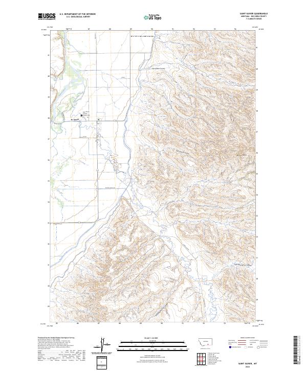
2024 Map of Saint Xavier
USGS Topo · Published 2024About this map
St. Xavier serves as the focal point of this Big Horn County landscape, where the Bighorn River and Rotten Grass Creek converge. The settlement is defined by its cultural and infrastructure landmarks, including the Saint Xavier Catholic Mission Cem and a local Po. The geography is shaped by the sophisticated water management of the Big Horn Canal, which skirts the western valley floor before the terrain rises into the dissected breaks of the Mission Buttes. Numerous named drainages, such as Del Howe Coulee and Saint Xavier Coulee, carve through the eastern uplands. These coulees, along with descriptors like West Dipping Vat Coulee, point to the region's long-standing ranching traditions and the practical necessity of navigating the complex coulee systems that feed into the river valley.
Find a feature on this map
24 named features on this map. Tap any name to fly to it.
Don’t see what you’re looking for? This feature index may not catch every label — zoom into the map to look around manually.
Map Details
Editions of this 2024 Saint Xavier Map
This is the sole edition of this map. No revisions or reprints were ever made.
Other maps of this area

1894 · St. Xavier
USGS Topo · 1:125,000

1894 · Fort Custer
USGS Topo · 1:125,000

1901 · St. Xavier
USGS Topo · 1:125,000

1954 · Hardin
USGS Topo · 1:250,000

1957 · Hardin
USGS Topo · 1:250,000

1958 · Hardin
USGS Topo · 1:250,000

1960 · Schick Ranch
USGS Topo · 1:24,000

1960 · St Xavier
USGS Topo · 1:24,000

1960 · St Xavier NE
USGS Topo · 1:24,000

1960 · Mission Coulee
USGS Topo · 1:24,000