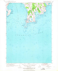
1955 Map of Sakonnet Point
USGS Topo · Published 1967About this map
Sakonnet Point anchors this mid-century coastal study, marking the southern tip of Little Compton where the Sakonnet River meets the Atlantic Ocean. The landscape is a mix of maritime utility and recreation, featuring the Sakonnet Golf Course, the protective breakwater at Sakonnet Harbor, and the iconic Sakonnet Light offshore. The presence of the Watch House and the U S Naval Reservation at Sachuest Pt reflects the strategic importance of this coastline during the era. Inland, the map details the varied wetlands and woods of the region, from the preserved Wilbour Woods to the brackish waters of Briggs Marsh and Quicksand Pond. Numerous family-named roads like Brownell Road and Taylors Lane provide a window into the local landownership and rural development patterns of 1950s Rhode Island.
Find a feature on this map
47 named features on this map. Tap any name to fly to it.
Don’t see what you’re looking for? This feature index may not catch every label — zoom into the map to look around manually.
Map Details
Editions of this 1955 Sakonnet Point Map
3 editions found
Other maps of this area

1885 · Sakonnet
USGS Topo · 1:62,500

1888 · Fall River
USGS Topo · 1:62,500

1888 · Sakonnet
USGS Topo · 1:62,500

1889 · Newport
USGS Topo · 1:62,500

1890 · Narragansett Bay
USGS Topo · 1:62,500

1892 · Narragansett Bay
USGS Topo · 1:62,500

1893 · Sakonnet
USGS Topo · 1:62,500

1893 · Fall River
USGS Topo · 1:62,500

1894 · Newport
USGS Topo · 1:62,500

1904 · Newport
USGS Topo · 1:62,500