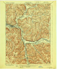
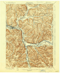
1900 Map of Salamanca
USGS Topo · Published 1928About this map
The Allegheny River valley serves as a critical transportation corridor in this turn-of-the-century landscape, where river bends are paralleled by an intricate network of rail lines. Several major railways converge here, including the Erie R. R. and the Rochester and Pittsburg RR, facilitating heavy transit through Salamanca and the industrial nodes at Salamanca Junction and Riverside Junction. This survey documents a transitional era for the region, balancing established settlements like Irvine Mills and South Carrollton with the emerging boundaries of the Alleghany State Park. Much of the central terrain is defined by the Alleghany Indian Reservation, which follows the river's winding path. Away from the main valley, the geography shifts toward narrower drainages like Nine Mile Creek and Great Valley Creek, where smaller hamlets such as Humphrey Center and Sugartown are tucked into the valleys between Pumpkin Hollow and Wings Hollow.
Find a feature on this map
69 named features on this map. Tap any name to fly to it.
Don’t see what you’re looking for? This feature index may not catch every label — zoom into the map to look around manually.
Map Details
Editions of this 1900 Salamanca Map
6 editions found
Other maps of this area

1898 · Olean
USGS Topo · 1:62,500

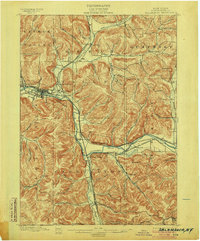
1900 · Salamanca
USGS Topo · 1:62,500

1922 · Randolph
USGS Topo · 1:62,500

1923 · Randolph
USGS Topo · 1:62,500

1923 · Cattaraugus
USGS Topo · 1:62,500

1924 · Ellicottville
USGS Topo · 1:62,500

1924 · Bradford
USGS Topo · 1:62,500

1924 · Franklinville
USGS Topo · 1:62,500

1926 · Bradford
USGS Topo · 1:62,500

1933 · Smethport
USGS Topo · 1:62,500