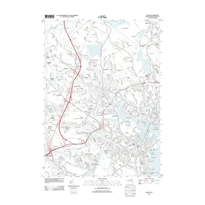
2012 Map of Salem
USGS Topo · Published 2012About this map
The maritime and colonial history of the North Shore is etched into this 2012 survey, from the Ancient Burying Ground near the coast to the infamous elevations of Gallows Hill and Witch Hill. This landscape is defined by its densely settled villages, including the historic centers of Danvers Center, Tapleyville, and Wenham. The coastal orientation is clear along Beverly Harbor, where navigation is aided by the Hospital Point Rear Range Light and the distinctive finger of Derby Wharf. Inland, the terrain is a mix of residential growth and preserved space, featuring numerous local landmarks like Brooksby Farm and the Putnamville Reservoir. Researchers will find a high concentration of genealogical sites, including the Old Settlers Cem, Holten Cem, and Sons of Jacob Cem, reflecting centuries of diverse community life in Essex County.
Find a feature on this map
413 named features on this map. Tap any name to fly to it.
Don’t see what you’re looking for? This feature index may not catch every label — zoom into the map to look around manually.
Map Details
Editions of this 2012 Salem Map
This is the sole edition of this map. No revisions or reprints were ever made.
Other maps of this area

1886 · Lawrence
USGS Topo · 1:62,500

1888 · Lawrence
USGS Topo · 1:62,500

1888 · Salem
USGS Topo · 1:62,500

1892 · Boston Bay
USGS Topo · 1:62,500

1893 · Salem
USGS Topo · 1:62,500

1893 · Boston
USGS Topo · 1:62,500

1893 · Lawrence
USGS Topo · 1:62,500

1903 · Boston
USGS Topo · 1:62,500

1903 · Boston Bay
USGS Topo · 1:62,500

1917 · Salem
USGS Topo · 1:62,500