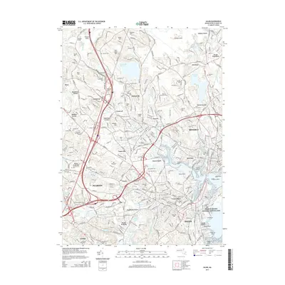
2015 Map of Salem
USGS Topo · Published 2015About this map
Salem and its surrounding coastal communities in Essex County are shown here as they appeared in 2015, revealing a densely layered landscape of early colonial history and modern development. The North Shore's unique geography is defined by a series of rocky points and coves, from Beverly Harbor and Tuck Point to the historic Salem Maritime National Historic Site. Inland, the map captures the transition from urban centers like Peabody and Lynn to the residential areas of Wenham and South Hamilton. Notable for genealogists and local historians, the map identifies numerous small neighborhoods and former industrial hubs such as Tapleyville, Hathorne, and Danversport. High points like the infamous Gallows Hill and Witch Hill rise above the surrounding valleys of Nichols Brook and Frost Fish Brook, while large water bodies like Wenham Lake and the Putnamville Reservoir remain central to the regional geography.
Find a feature on this map
157 named features on this map. Tap any name to fly to it.
Don’t see what you’re looking for? This feature index may not catch every label — zoom into the map to look around manually.
Map Details
Editions of this 2015 Salem Map
This is the sole edition of this map. No revisions or reprints were ever made.
Other maps of this area

1886 · Lawrence
USGS Topo · 1:62,500

1888 · Lawrence
USGS Topo · 1:62,500

1888 · Salem
USGS Topo · 1:62,500

1892 · Boston Bay
USGS Topo · 1:62,500

1893 · Salem
USGS Topo · 1:62,500

1893 · Boston
USGS Topo · 1:62,500

1893 · Lawrence
USGS Topo · 1:62,500

1903 · Boston
USGS Topo · 1:62,500

1903 · Boston Bay
USGS Topo · 1:62,500

1917 · Salem
USGS Topo · 1:62,500