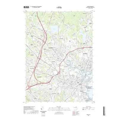
2021 Map of Salem
USGS Topo · Published 2021About this map
Salem and the surrounding Essex County shoreline appear here in a complex network of coastal inlets and suburban development. The landscape is defined by its deep historical roots, evidenced by numerous burial sites such as the Old Settlers Burying Ground and the Peabody Family Burying Ground. Waterways like the Bass River and North River flow into the harbor, framing the Salem Maritime National Historic Site and South Salem.
Find a feature on this map
118 named features on this map. Tap any name to fly to it.
Don’t see what you’re looking for? This feature index may not catch every label — zoom into the map to look around manually.
Map Details
Editions of this 2021 Salem Map
This is the sole edition of this map. No revisions or reprints were ever made.
Other maps of this area

1886 · Lawrence
USGS Topo · 1:62,500

1888 · Lawrence
USGS Topo · 1:62,500

1888 · Salem
USGS Topo · 1:62,500

1892 · Boston Bay
USGS Topo · 1:62,500

1893 · Salem
USGS Topo · 1:62,500

1893 · Boston
USGS Topo · 1:62,500

1893 · Lawrence
USGS Topo · 1:62,500

1903 · Boston
USGS Topo · 1:62,500

1903 · Boston Bay
USGS Topo · 1:62,500

1917 · Salem
USGS Topo · 1:62,500