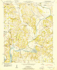
1951 Map of Salem
USGS Topo · Published 1951About this map
The Elk River winds through this landscape near the Alabama-Tennessee border, defining the local geography with its broad bends and associated hollows like Smith Hollow and Buzzard Roost Hollow. In the southern portion of the map, the Wheeler Reservoir backwaters meet the river current, surrounding Buck Island and creating the Round Bottom wetlands. A significant mid-century industrial presence is seen at the Elk River Fish Hatchery, situated along the river's south bank near the confluence of Sulphur Creek.
Find a feature on this map
101 named features on this map. Tap any name to fly to it.
Don’t see what you’re looking for? This feature index may not catch every label — zoom into the map to look around manually.
Map Details
Editions of this 1951 Salem Map
3 editions found
Other maps of this area

1888 · Huntsville
USGS Topo · 1:125,000

1892 · Huntsville
USGS Topo · 1:125,000

1935 · Athens
USGS Topo · 1:24,000

1936 · Union Hill
USGS Topo · 1:24,000

1936 · Aspen Hill
USGS Topo · 1:24,000

1936 · Elkmont
USGS Topo · 1:24,000

1936 · Ripley
USGS Topo · 1:24,000

1936 · Appleton
USGS Topo · 1:24,000

1936 · Cairo
USGS Topo · 1:24,000

1936 · Elkton
USGS Topo · 1:24,000