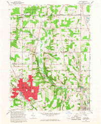
1966 Map of Salem
USGS Topo · Published 1968About this map
Salem sits at a crossroads of industrial and agricultural history in the mid-1960s, anchoring a landscape shaped by the Penn Central and Erie Lackawanna railroads. The map captures the dense urban core of the city, including civic landmarks like City Hall, the Library, and several local schools such as McKinley Sch and St Pauls Sch. To the east, the coal and clay heritage of the region is evident in the cluster of kilns, mines, and gravel pits surrounding Millville and Washingtonville.
Find a feature on this map
73 named features on this map. Tap any name to fly to it.
Don’t see what you’re looking for? This feature index may not catch every label — zoom into the map to look around manually.
Map Details
Editions of this 1966 Salem Map
3 editions found
Other maps of this area

1906 · Youngstown
USGS Topo · 1:62,500

1907 · Columbiana
USGS Topo · 1:62,500

1908 · Youngstown
USGS Topo · 1:62,500

1908 · Warren
USGS Topo · 1:62,500

1909 · Lisbon
USGS Topo · 1:62,500

1909 · Columbiana
USGS Topo · 1:62,500

1950 · Cleveland
USGS Topo · 1:250,000

1951 · Canton
USGS Topo · 1:250,000

1951 · Columbiana
USGS Topo · 1:24,000

1951 · Youngstown
USGS Topo · 1:24,000