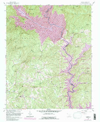
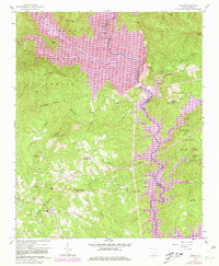
1959 Map of Salem
USGS Topo · Published 1988About this map
Salem lies at the heart of this landscape where the Blue Ridge Mountains descend into the newly formed reservoirs of the late twentieth century. This survey, based on 1950s data with later revisions, shows the dramatic transformation of the Oconee and Pickens county line as the Lake Jocassee and Lake Keowee projects reshaped the local topography. The map documents numerous mountain landmarks and family-named peaks such as McKinney Mtn and Smeltzer Mtn, alongside cultural sites like McKinney Chapel and Fall Creek Ch. Extensive timberlands of the Sumter National Forest dominate the northern terrain, while the southeastern corner transition into the Keowee Toxaway State Park. This record is particularly valuable for genealogists and local historians tracking the shift from river-bottom farming and mountain homesteading to a landscape defined by large-scale hydroelectric development and conservation.
Find a feature on this map
47 named features on this map. Tap any name to fly to it.
Don’t see what you’re looking for? This feature index may not catch every label — zoom into the map to look around manually.
Map Details
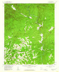
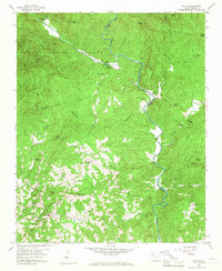
Editions of this 1959 Salem Map
5 editions found

Other maps of this area

1886 · Walhalla
USGS Topo · 1:125,000

1888 · Pickens
USGS Topo · 1:125,000

1891 · Cowee
USGS Topo · 1:125,000

1892 · Walhalla
USGS Topo · 1:125,000

1894 · Pickens
USGS Topo · 1:125,000

1896 · Walhalla
USGS Topo · 1:125,000

1897 · Cowee
USGS Topo · 1:125,000

1905 · Pisgah
USGS Topo · 1:125,000

1906 · Pisgah
USGS Topo · 1:125,000

1907 · Cowee
USGS Topo · 1:125,000