
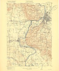
1917 Map of Salem
USGS Topo · Published 1917About this map
The Willamette River defines the central axis of this Oregon landscape, carving through fertile agricultural plains and supporting a complex network of river landings and early infrastructure. The state capital, Salem, appears as a developing hub at the confluence of the river and major rail lines, including the Southern Pacific and the Oregon Electric railway. Notable for its concentration of early twentieth-century social infrastructure, the map identifies specialized facilities such as the State Institution for Feeble-Minded, the Oregon State Training School, and the Poor Farm School for the Deaf. To the west and south, the terrain transitions into the Croisan Ridge and small farming communities like Monmouth and Independence. Significant lowlands like Keizer Bottom and American Bottom highlight the river's historical floodplains, marked by landings such as Wigrich Landing and Wells Landing that once served the valley's maritime economy.
Find a feature on this map
112 named features on this map. Tap any name to fly to it.
Don’t see what you’re looking for? This feature index may not catch every label — zoom into the map to look around manually.
Map Details
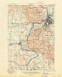
Editions of this 1917 Salem Map
3 editions found
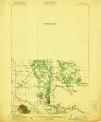
Other maps of this area

1912 · Jefferson
USGS Topo · 1:31,680

1913 · Wells
USGS Topo · 1:31,680

1914 · Independence
USGS Topo · 1:31,680

1914 · Soap Creek
USGS Topo · 1:31,680

1915 · Rickreall
USGS Topo · 1:31,680

1915 · Eola
USGS Topo · 1:31,680

1915 · Sidney
USGS Topo · 1:31,680

1916 · Albany
USGS Topo · 1:62,500
1921 · Lebanon
USGS Topo · 1:62,500

1921 · Corvallis
USGS Topo · 1:62,500