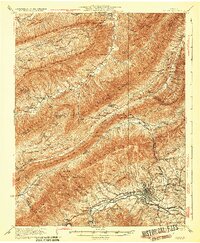
1932 Map of Salem
USGS Topo · Published 1932About this map
Salem sits at the foot of Fort Lewis Mountain, serving as a focal point for commerce and transport along the Roanoke River during the early 1930s. The landscape is defined by the steep ridges of Catawba Mountain and North Mountain, where narrow gaps like McAfee Gap provided critical passage for travelers. This survey captures a moment when the regional economy was deeply tied to the land, shown by the numerous small schools and churches that anchored rural life, such as Enterprise Sch and Salem Ch.
Find a feature on this map
80 named features on this map. Tap any name to fly to it.
Don’t see what you’re looking for? This feature index may not catch every label — zoom into the map to look around manually.
Map Details
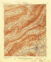
Editions of this 1932 Salem Map
3 editions found

Other maps of this area

1887 · Lewisburg
USGS Topo · 1:125,000

1890 · Roanoke
USGS Topo · 1:125,000

1890 · Christiansburg
USGS Topo · 1:125,000

1891 · Roanoke
USGS Topo · 1:125,000

1891 · Lewisburg
USGS Topo · 1:125,000

1894 · Natural Bridge
USGS Topo · 1:125,000

1913 · Eagle Rock
USGS Topo · 1:48,000

1915 · Eagle Rock
USGS Topo · 1:62,500

1921 · Ronceverte
USGS Topo · 1:48,000

1923 · Ronceverte
USGS Topo · 1:62,500