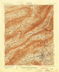
1932 Map of Salem
USGS Topo · Published 1945About this map
Salem sits at the heart of this valley landscape, where the Roanoke River and the Norfolk and Western railway follow the natural corridor between the ridges of the Blue Ridge and Appalachian mountains. The survey captures the region during a period of transition, documented in the late 1920s, showing the concentrated development of Edgewood and Sunset Village near the city, while the surrounding hills remain dotted with small rural institutions like Shiloh Ch, Gum Springs Sch, and Webbs Mill.
Find a feature on this map
81 named features on this map. Tap any name to fly to it.
Don’t see what you’re looking for? This feature index may not catch every label — zoom into the map to look around manually.
Map Details
Editions of this 1932 Salem Map
3 editions found

Other maps of this area

1887 · Lewisburg
USGS Topo · 1:125,000

1890 · Roanoke
USGS Topo · 1:125,000

1890 · Christiansburg
USGS Topo · 1:125,000

1891 · Roanoke
USGS Topo · 1:125,000

1891 · Lewisburg
USGS Topo · 1:125,000

1894 · Natural Bridge
USGS Topo · 1:125,000

1913 · Eagle Rock
USGS Topo · 1:48,000

1915 · Eagle Rock
USGS Topo · 1:62,500

1921 · Ronceverte
USGS Topo · 1:48,000

1923 · Ronceverte
USGS Topo · 1:62,500