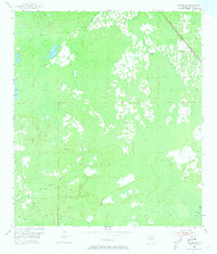
1954 Map of Salem SW
USGS Topo · Published 1973About this map
The Atlantic Coast Line railroad cuts diagonally across the northeastern corner of this Florida landscape, representing a vital transportation artery through the low-lying terrain of Taylor County during the mid-1950s. The interior is defined by a complex network of wetlands and water bodies, including Minom Sog, Coker Sog, and the California Sinks. These features, along with Bevins Creek and California Creek, illustrate the natural drainage patterns characteristic of the Gulf Coast region.
Find a feature on this map
11 named features on this map. Tap any name to fly to it.
Don’t see what you’re looking for? This feature index may not catch every label — zoom into the map to look around manually.
Map Details
Editions of this 1954 Salem SW Map
4 editions found
Other maps of this area

1954 · Clara
USGS Topo · 1:24,000

1954 · Salem SW
USGS Topo · 1:24,000

1954 · Jena
USGS Topo · 1:24,000

1954 · Cooks Hammock
USGS Topo · 1:24,000

1954 · Warrior Swamp
USGS Topo · 1:24,000

1954 · Salem
USGS Topo · 1:24,000

1954 · Steinhatchee
USGS Topo · 1:24,000

1954 · Keaton Beach
USGS Topo · 1:24,000

1954 · Crooked Point
USGS Topo · 1:24,000

1954 · Gainesville
USGS Topo · 1:250,000