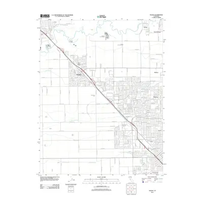
2012 Map of Salida
USGS Topo · Published 2012About this map
The Stanislaus River defines the northern reaches of this territory, where the suburban expansion of north Modesto meets the agricultural heritage of the Central Valley. Residential growth is evident in settlements such as Standiford and North McHenry, while the community of Salida serves as a primary hub along the established transportation corridors. The landscape is heavily marked by an intricate irrigation system, including Lateral Number Six and Lateral Number Seven, which supports the area's continued dairy and farming operations. Institutional and recreational landmarks like Modesto Junior College and the Modesto Municipal Golf Course provide local focal points for the community. Genealogists and local historians can locate the Woodcolony Cem situated between the expanding residential blocks and the agricultural fields, alongside family-run operations like Rocking S Dairy Number 1.
Find a feature on this map
189 named features on this map. Tap any name to fly to it.
Don’t see what you’re looking for? This feature index may not catch every label — zoom into the map to look around manually.
Map Details
Editions of this 2012 Salida Map
This is the sole edition of this map. No revisions or reprints were ever made.
Other maps of this area

1914 · Manteca
USGS Topo · 1:31,680

1914 · Avena
USGS Topo · 1:31,680

1915 · Ripon
USGS Topo · 1:31,680

1915 · Westport
USGS Topo · 1:31,680

1915 · Westley
USGS Topo · 1:31,680

1915 · Salida
USGS Topo · 1:31,680

1915 · Thalheim
USGS Topo · 1:31,680

1916 · Riverbank
USGS Topo · 1:31,680

1916 · Ceres
USGS Topo · 1:31,680

1939 · Modesto East
USGS Topo · 1:62,500